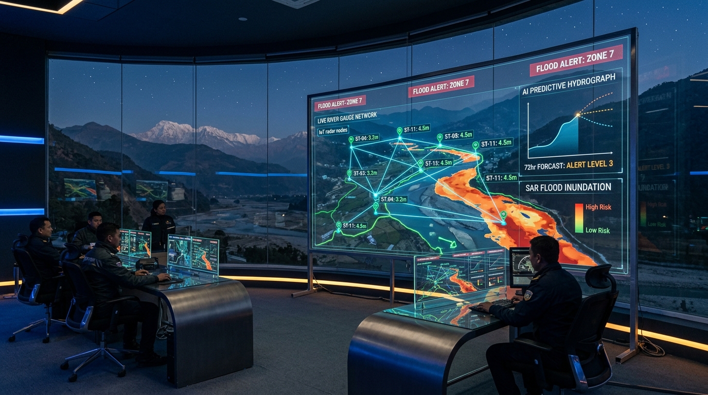
Every monsoon across the Koshi, Gandaki, Karnali, and Bagmati river basins, Nepal confronts a familiar catastrophe: swollen rivers breaching embankments, catastrophic debris flows triggered by cloudbursts, and lives upended in minutes. The post-disaster discourse almost always fixates on relief logistics and structural embankments.
Yet, from an engineering and computing standpoint, the fundamental failure in disaster management is an information latency failure.
Floods in the steep, geologically young terrain of the Himalayas move with terrifying velocity. When a cloudburst strikes an upstream catchment in the mid-hills or high mountains, downstream settlements in the Terai and river valleys often have a critical window of 45 minutes to 6 hours before water and debris crest their banks. Whether that window saves thousands of lives or results in disaster depends entirely on the architecture of our hydrological telemetry, predictive models, and last-mile alerting systems.
Let us break down the physical mechanics of Himalayan floods, examine what technologies have been deployed across Nepal today, and detail the technical stack required to build an autonomous, resilient early-warning infrastructure.
1. The Himalayan Problem: Why Standard Flood Models Fail
Most commercial flood forecasting systems were built for broad, low-gradient continental basins like the Mississippi or the Rhine. In those environments, water accumulation is gradual, rainfall is relatively homogeneous over large grids, and 2D hydraulic models have days to compute overland flow vectors.
Nepal’s hydro-geomorphology presents three distinct physics challenges that break standard models:
- Extreme Hypsometry & Topographic Gradient: Rivers descend thousands of meters across horizontal distances of less than 100 kilometers. Catchment response times are hyper-compressed; rainfall-runoff lag times are measured in fractions of hours rather than days.
- Debris and Sediment Loading: Himalayan flash floods are rarely clean water events. Heavy monsoonal precipitation destabilizes fragile slopes, turning rivers into high-density non-Newtonian hyper-concentrated slurries of mud, boulders, and timber. Traditional submerged acoustic sensors or mechanical float gauges are physically sheared off and obliterated within minutes of a major surge.
- Hyper-Localized Orographic Microclimates: A single ridge can receive 180 mm of intense precipitation in 90 minutes while a weather station 8 kilometers away in the valley records light drizzle. Coarse satellite precipitation products like standard GPM (Global Precipitation Measurement) often underestimate or lag behind sudden mountain cloudbursts.
Solving flood resilience in Nepal is therefore not simply a software challenge—it is an end-to-end edge computing, robust telemetry, and low-latency modeling challenge.
2. What Is Currently Built: Nepal’s Existing Technology Footprint
Over the last decade, Nepal’s Department of Hydrology and Meteorology (DHM), in partnership with international bodies (ICIMOD, Practical Action, UNDP) and telecommunications operators, has laid crucial foundational infrastructure:
- Automated Telemetry Stations: DHM operates a network of Automated Water Level (AWL) and Automated Weather Stations (AWS) equipped with cellular (GPRS/CDMA) and satellite modems that transmit stage height and precipitation data to centralized servers in Kathmandu every 5 to 15 minutes.
- The ‘1155’ Automated Warning Toll-Free Service: When river stations cross designated “Warning” or “Danger” thresholds, automated algorithms trigger mass SMS broadcasts to geo-fenced mobile phone subscribers residing in vulnerable downstream zones via Nepal Telecom (NTC) and Ncell. The public can also dial the 1155 toll-free IVR hotline to hear live river statuses.
- GloFAS & Regional Hydrological Frameworks: DHM ingests ECMWF’s GloFAS (Global Flood Awareness System) and localized runoff predictions to anticipate medium-range (3 to 10-day) river basin volume surges, enabling humanitarian agencies to trigger anticipatory actions.
Where the Existing Stack Hits Bottlenecks
While these systems have saved thousands of lives during broad riverine inundations, they suffer from critical architectural weaknesses during high-velocity flash floods:
- Cellular Network Fragility: Cellular towers frequently lose grid power or backhaul fiber connectivity precisely when the storm hits, cutting off real-time data transmission from remote upstream stations.
- Submerged Sensor Mortality: Traditional submerged pressure transducers get buried under meters of bedload sediment or damaged by boulder impacts during debris flows.
- The Last-Mile Information Gap: SMS delivery in mountainous river bends often suffers from delivery delays (up to 30–60 minutes during peak network congestion) or fails to wake sleeping villagers in the middle of the night.
3. The Modern Sensing Stack: Non-Contact Radar & LoRa Mesh Telemetry
To overcome the physical vulnerability of in-stream sensors, the global hydrology community has shifted decisively toward non-contact sensing and decentralized communication.
[ Upstream Non-Contact Radar Sensor ] (Mounted 10m above flood line on bridge)
                 │
                 ▼
[ Edge Microcontroller / ESP32-S3 ] (Calculates surface velocity & stage)
                 │
      ┌──────────┴──────────┐
      ▼                     ▼
[ Satellite Iridium ]   [ 868/915 MHz LoRa Mesh Nodes ] (Repeated across ridges)
      │                     │
      └──────────┬──────────┘
                 ▼
[ Base Gateway / Solar-Powered Autonomous Siren Station ]
                 │
                 ▼
[ Centralized AI Hydro-Engine & Community Alert Network ]
A. High-Frequency 80 GHz Non-Contact FMCW Radar
Instead of placing sensors in the water, stations are mounted on bridge decks, reinforced cantilever arms, or cliff overhangs 5 to 15 meters above maximum anticipated flood lines.
80 GHz Frequency-Modulated Continuous-Wave (FMCW) radar transceivers measure the distance to the water surface with millimeter accuracy through heavy rainfall, mist, and steam without touching the water. When paired with surface velocity radar (SVR) utilizing the Doppler shift of surface waves, the system calculates both stage and surface velocity, deriving real-time volumetric discharge using hydraulic cross-sectional equations.
B. LoRa & LPWAN Autonomous Radio Mesh
Because cellular infrastructure fails during peak storms, telemetry nodes should operate over sub-gigahertz LoRa (Long Range) radio networks.
A chain of low-power, solar-charged LoRa relay nodes placed on mountain crests can transmit water-level packets across 15–30 km line-of-sight hops without relying on cellular towers or grid power. Even if the cellular network in the valley collapses, upstream river surge packets reach the downstream base station and trigger local mechanical sirens autonomously.
4. Upstream Threat Detection: Satellite SAR & Glacial Outbursts (GLOFs)
Nepal faces two distinct upstream hydrometeorological hazards: mid-hill flash floods and Glacial Lake Outburst Floods (GLOFs) from moraine-dammed lakes in the high Himalayas (such as Tsho Rolpa, Imja, or Thorthormi).
Because high-altitude glaciated zones are virtually inaccessible during the monsoon, optical satellites are blinded by dense cloud cover. The technological solution is Synthetic Aperture Radar (SAR):
- Cloud-Penetrating SAR (Sentinel-1, NISAR): Radar satellites beam C-band or L-band microwave pulses through thick cloud cover and rainfall, measuring the backscatter reflectance. Water appears completely dark (specular reflection), while land and debris reflect energy back.
- Automated SAR Inundation Segmentation: Convolutional Neural Networks (CNNs) and transformer-based segmentation models process SAR data to map water surface extent changes across entire river basins within hours of an orbit pass.
- InSAR Surface Deformation Monitoring: Interferometric Synthetic Aperture Radar (InSAR) tracks millimeter-scale movements of unstable moraine dams and landslide dams before they fail, providing days of early warning before a breach occurs.
5. The Machine Learning Engine: Physics-Informed Neural Networks for Runoff
Historical statistical regression models fail when climate change generates rainfall intensities that fall outside historical training distributions.
The state-of-the-art approach combines physics-based hydrological differential equations with deep learning:
- Long Short-Term Memory (LSTM) Networks: Hydrologists have demonstrated (notably through Google Research’s global Flood Hub initiative) that LSTM networks trained on catchment characteristics (soil porosity, slope, drainage area) outperform traditional conceptual rainfall-runoff models in ungauged and data-sparse basins.
- Graph Neural Networks (GNNs): River networks are natural spatial graphs where nodes represent sensor junctions and edges represent river channels. GNNs model downstream wave propagation and routing dynamics, factoring in tributary confluence surges simultaneously.
- Pre-computed Flood Depth Inundation Libraries: Rather than attempting to run computationally prohibitive 2D hydrodynamic simulations (like HEC-RAS or TELEMAC) in real-time during a disaster, high-resolution digital elevation models (DEMs from LiDAR or ALOS) are pre-simulated for thousands of discharge scenarios. When the ML model predicts a peak discharge of $3,200\text{ m}^3/\text{s}$, the system instantly fetches the matching inundation vector layer.
6. The Last-Mile: Turning Data into Immediate Human Action
A 30-minute early warning is worthless if it sits inside an analytical dashboard in a government ministry. The engineering pipeline must terminate in direct, unblockable public alerts:
- Cell Broadcast (Emergency Alert System): Unlike standard SMS (which queues messages sequentially and collapses under network congestion), Cell Broadcast transmits a high-priority alert simultaneously to every connected handset within targeted cell towers within seconds, overriding silent modes with a standardized alarm tone.
- Autonomous Hardwired & Solar-Powered Siren Towers: Downstream flood-prone villages must have dual-redundant siren poles equipped with strobe lights and multi-tone sirens that trigger directly via LoRa radio signal when upstream radar nodes detect a threshold breach—even with zero internet.
- Community-Integrated Telegram & WhatsApp Bots: Direct integrations that deliver simple, actionable status visualizers (green/yellow/red risk levels with exact landmark references) to ward offices, local youth clubs, and emergency responders.
Summary Matrix: Essential Flood Warning Technologies
| Component | Legacy Technology | Modern Resilient Tech Stack | Primary Advantage in Nepal |
|---|---|---|---|
| Water Level Sensing | Submerged pressure transducers | 80 GHz Non-contact FMCW Radar | Immune to sediment burial & debris shearing |
| Telemetry Network | 2G/3G Cellular GPRS modems | Dual-mode LoRa Radio Mesh + Iridium Satellite | Operates through cellular & power grid outages |
| Glacial & Landslide Tracking | Optical satellite imagery | Satellite Synthetic Aperture Radar (SAR / InSAR) | Penetrates heavy monsoon cloud cover 24/7 |
| Forecasting Engine | Empirical threshold extrapolation | Physics-Informed LSTMs & Graph Neural Networks | Accurate predictions in uncalibrated mountain basins |
| Public Alert Delivery | Queued bulk SMS | Cell Broadcast + Automated LoRa Sirens | Zero-latency delivery; bypasses cellular congestion |
Frequently Asked Questions
Why do submerged water sensors fail so frequently in Himalayan rivers?
Himalayan rivers carry enormous volumes of abrasive bedload sediment, large boulders, and uprooted trees during monsoons. Submerged sensors get battered by impact forces or buried under several meters of silt within hours. Non-contact radar sensors mounted high above the water surface eliminate physical contact entirely.
How does LoRa mesh radio work when cell phone networks go down?
LoRa operates on license-free sub-gigahertz radio frequencies (868/915 MHz) using Chirp Spread Spectrum modulation. Nodes consume tiny amounts of power (running on small solar panels and lithium iron phosphate batteries) and pass data packets from node to node across mountain ridges directly, bypassing cell towers, internet routers, and the electrical grid.
Can AI predict flash floods without expensive ground sensors on every stream?
Yes. Modern deep learning architectures (like physics-informed LSTMs) can generalize runoff predictions across ungauged basins by learning the relationships between satellite precipitation data, soil moisture estimates, elevation topography, and catchment geometry. However, high-accuracy ground radar nodes on major upstream arteries remain essential for ground-truth validation and immediate alert triggering.
Dispatches and technical evaluations by Saurav Karki for Kritrimta.